Cartography by Missy Washington
instagram | emailIn another life I was probably a 15th-century monk mapping the new world by flame. Fortunately now I have electricity, coffee and podcasts.
Many of the maps I create are by commission. They detail significant places and events in someone’s life. I can’t think of a more personalized gift. If you have someone that you really want to wow - for big birthday, graduation, anniversary, etc - map is the way to go.


Project Highlights


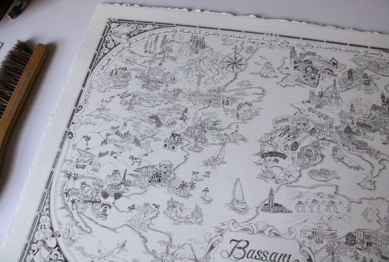
Commissioned for Formula One racer in United Arab Emirates
Bassam Map
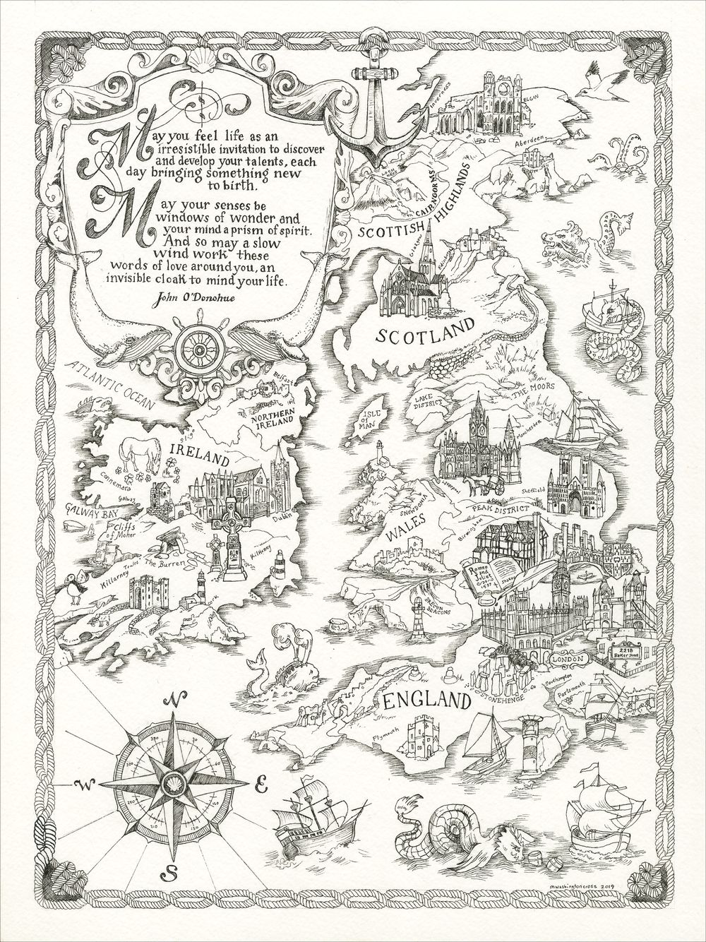
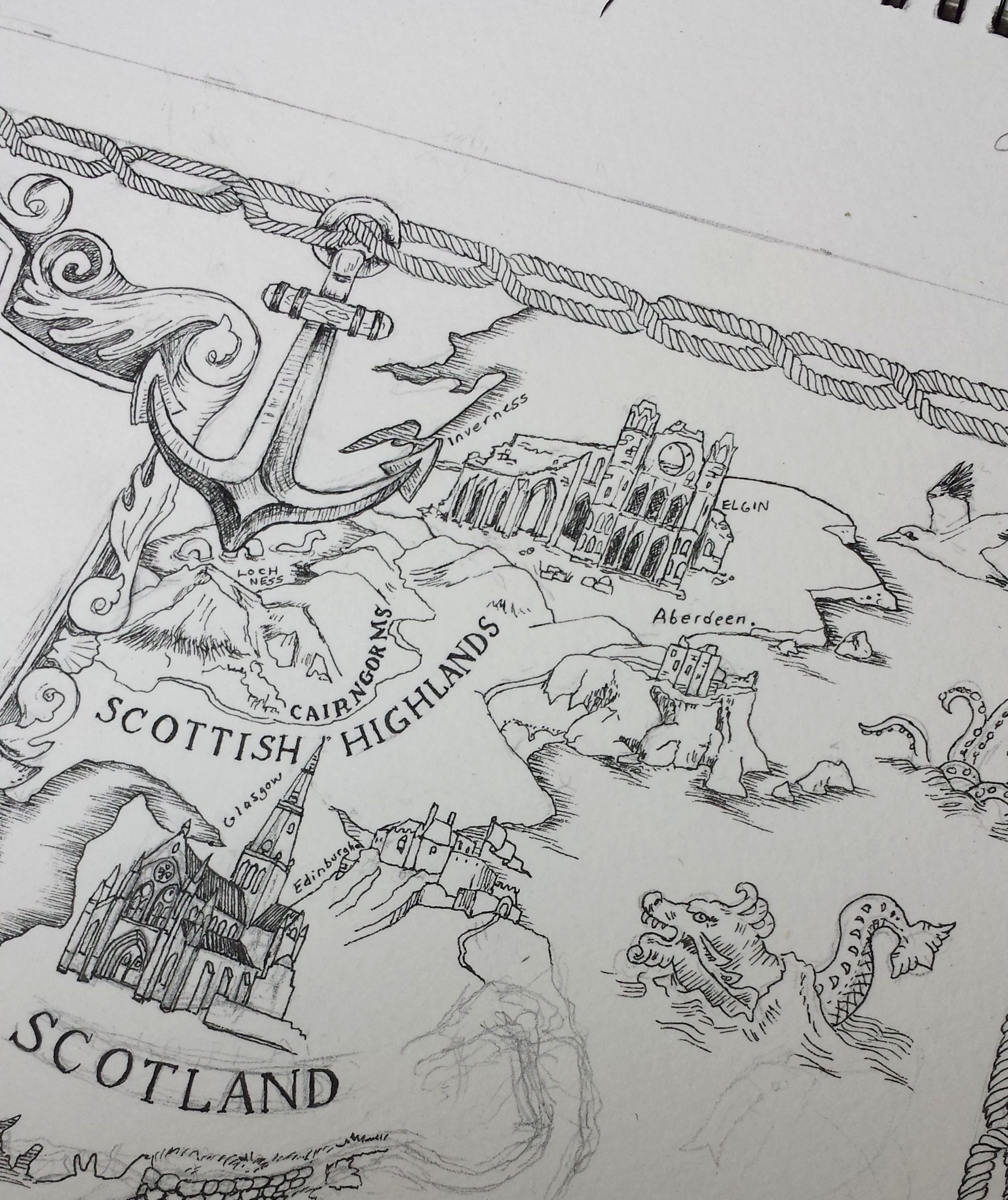
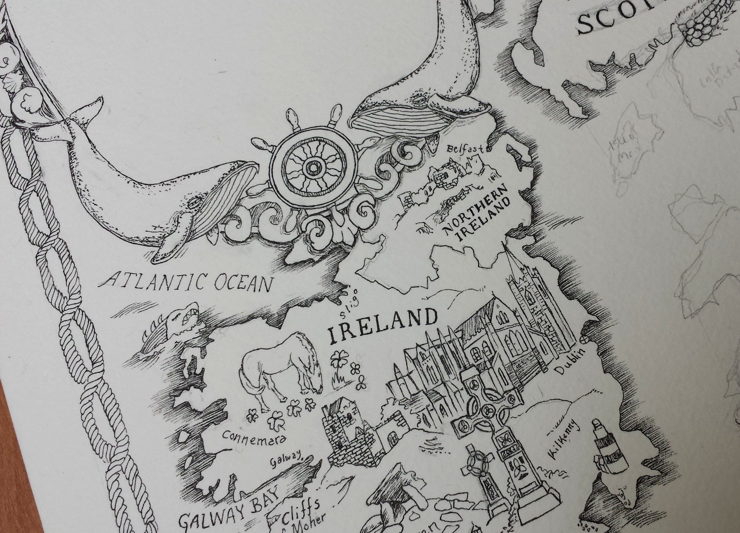
Map of UK
Illustrated map of the UK, depicting England, Scotland, Wales, Ireland and Northern Ireland. Map is nautical themed with a nautical rope border, two whales, seashells, many explorer-era boats and sea creatures. On land, illustrations of important places, castles, and cathedrals; including: London Towers, Big Ben and Parliament, Stonehenge, the canals at Cambridge, Shakespeare’s home, Pembroke Castle, Snowdonia and Brecon Beacons, Manchester Cathedral, The Moors and Lake District, Hadrian's Wall, Glasgow Cathedral, Edinburgh Castle, Dunnottar Castle, Elgin Cathedral Ruins, St Patrick's Cathedral, The Burren, Cliffs of Moher, Blarney Castle, and a many other goodies.
Inscription reads:
“May you feel life as an irresistible invitation to discover and develop your talents, each day bringing something new to birth.
May your senses be windows of wonder and your mind a prism of spirit.
And so may a slow wind work these words of love around you, an invisible cloak to mind your life.”
- John O’Donahue


Editorial map for the book, In the Land of the White Death, the published journals of Russian navigator, Valerian Albanov. Albanov was aboard an Arctic expedition in the Kara Sea in 1912 when the ship he was navigating became frozen in pack ice. The crew tried to endure in hopes that it would thaw, but after a year and half, Albanov decided to abandon the ship. Thirteen crew members followed him in an extraordinary journey on foot through the ice.
The Barren Septentrion: Mortem Ix Terra Alba (In the Land of the White Death)

Sierra Maps
CATHEDRAL PEAK
This map illustrates Cathedral Peak in Yosemite’s Tuolumne Meadows. Standing almost 11k feet tall, Cathedral is easy to spot from nearly any high point in the region. On its southwest flank rises the campanile of the cathedral - Eichorn Pinnacle. According to The Geologic Study of Yosemite, “the peak projected above the glaciers, which carved and sharpened the peak's base while plucking away at its sides.” The “plucking” left some very climbable flakes. John Muir free-soloed the face in Sept 1869 in some clodhopper boots, so we should have no problems.
“No feature of all the noble landscape seems more wonderful than the Cathedral itself, a temple displaying Nature's best masonry and sermons in stones. “ ~ John Muir

BEAR CREEK SPIRE
This iconic peaks towers over the entire Little Lakes Valley Trail as it weaves through quiet alpine lakes, marshes, and forests. Hermann Ulrichs first climbed the spire in 1903. Today the Northeast Ridge and the North Arete are some of the Sierra’s most classic climbs.
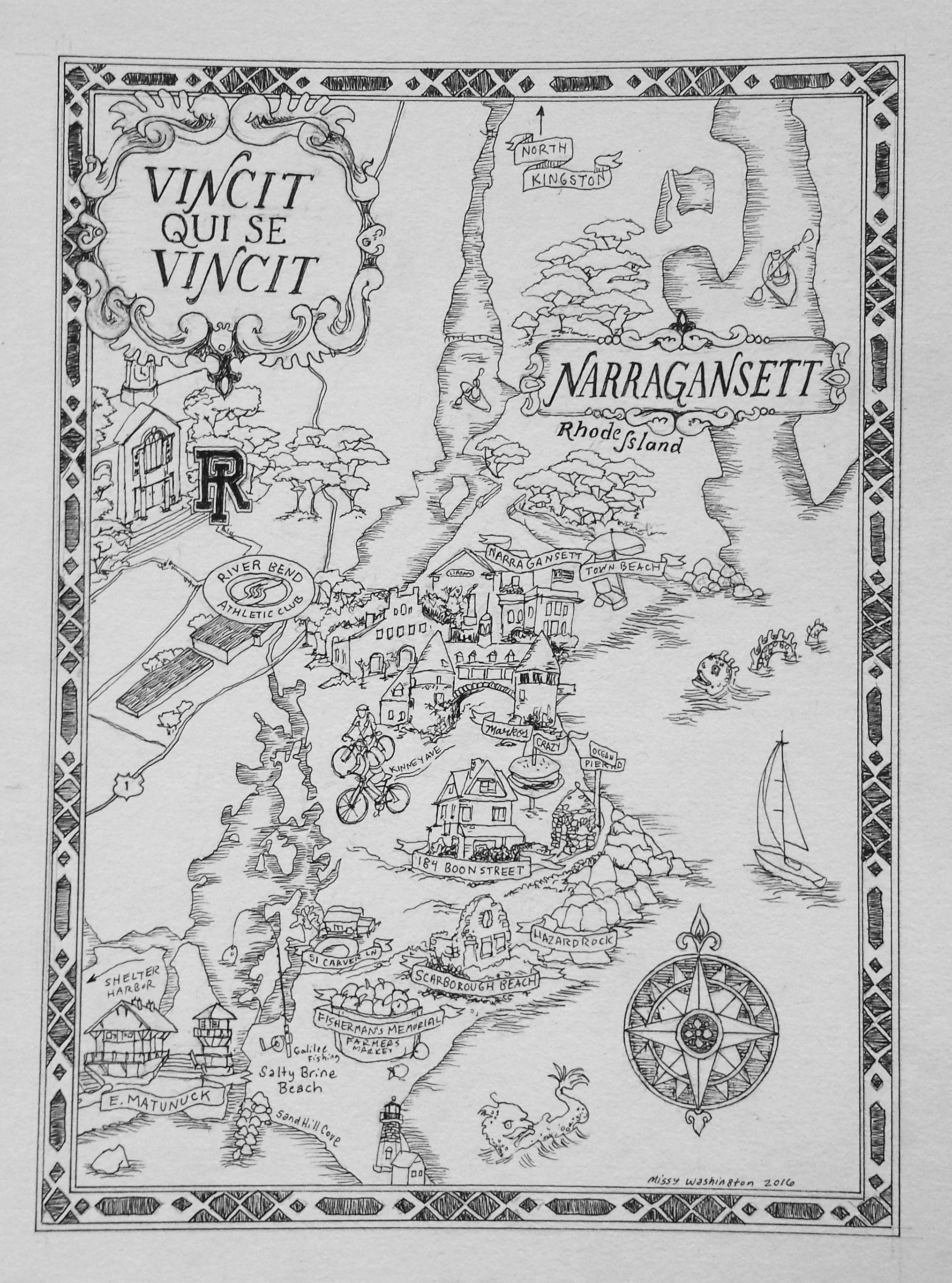


Assorted Commissioned Maps
Narragansett, Rhode Island, World Map, Osawa Island, Canada
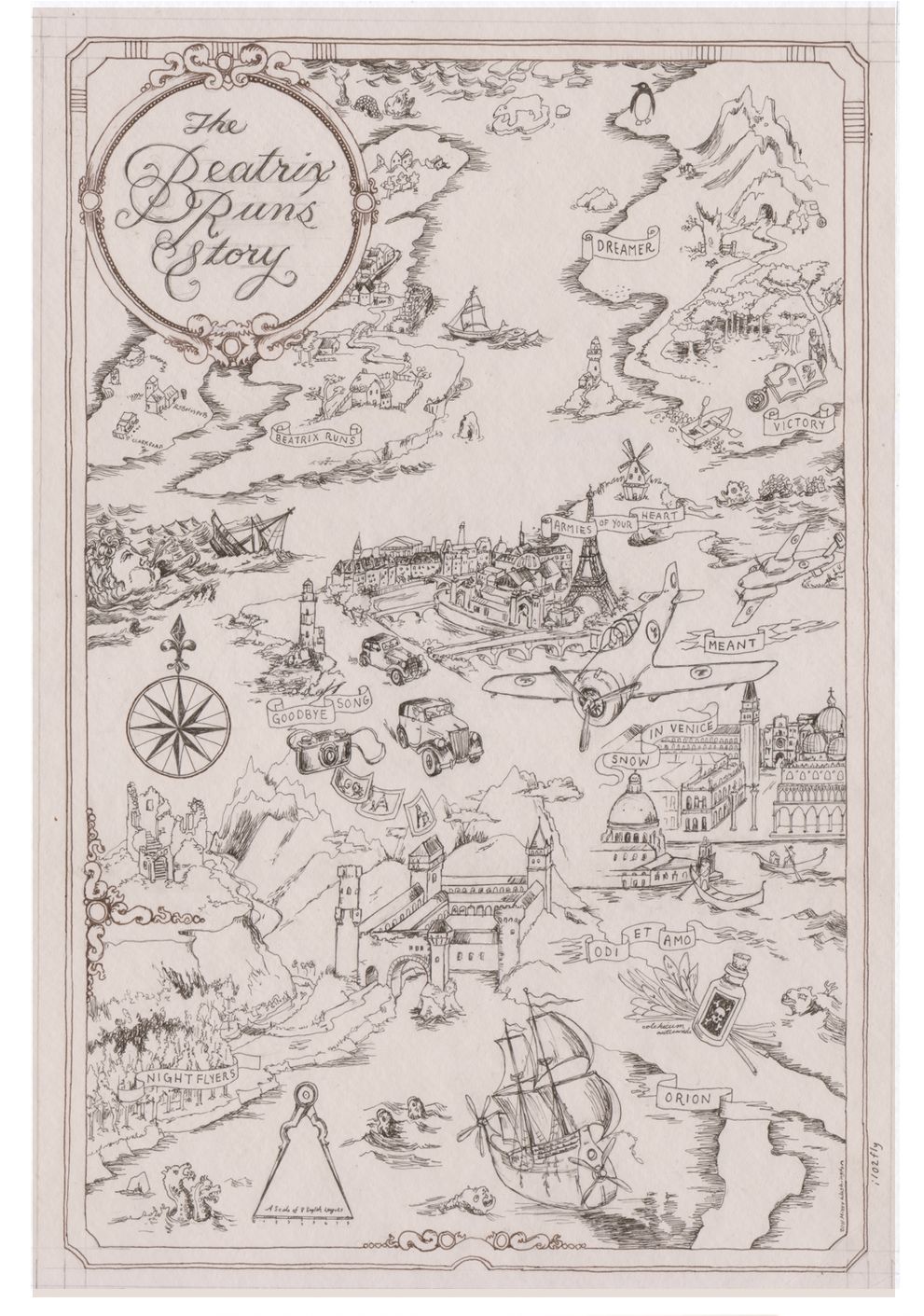
Beatrix Runs Map
Album art for Universal Records musician Elizaveta

